Rural Boundary Adjustment in Glenbrook
Project Lead: John Rowe, Director (Surveying)
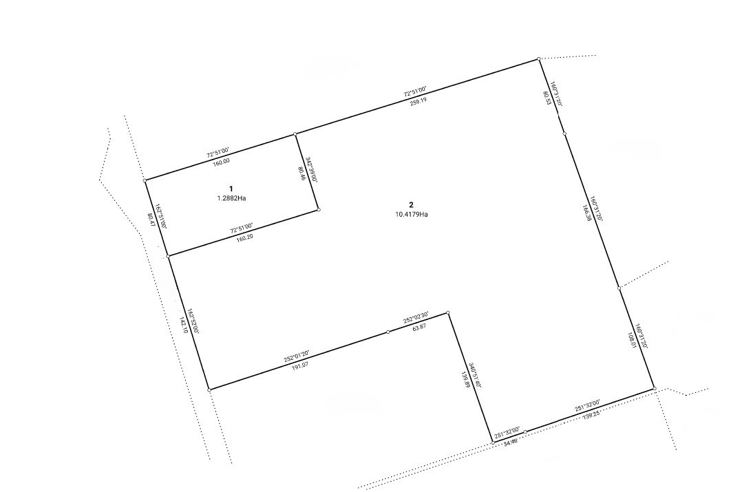
Tripp Andrews was engaged to complete a rural boundary adjustment involving the transfer of approximately two hectares of land to an adjoining horticultural business.
The land was surplus to our client’s needs but provided a valuable expansion opportunity for the neighbouring property. The boundary needed to be repositioned to reflect the land agreed for sale and allow the transaction to be completed.
The Challenge
The project required an efficient surveying and consenting process so the sale could proceed without unnecessary delays.
Key considerations included:
- Repositioning the boundary to match the area agreed between the landowners
- Securing resource consent with minimal council back-and-forth
- Completing the subdivision and registering the new titles so the transaction could be finalised
- Addressing council concerns about the absence of Specified Building Areas without creating an unnecessary restriction on the titles
Speed was particularly important because the adjoining horticultural business wanted to secure the land for its expansion.
Our Approach
Tripp Andrews provided the surveying and planning services required to take the boundary adjustment from the initial scheme through to completion.
Our work included:
- Preparing the scheme plan
- Preparing and lodging the resource consent application
- Managing the application through to approval
- Completing the land transfer subdivision
- Obtaining Section 223 approval
- Securing Section 224(c) certification
The application progressed with minimal Requests for Information from council. When council raised the absence of Specified Building Areas on the scheme plan, our team successfully resolved the issue without adding an unnecessary building restriction to the titles.
Solution Delivered
- Resource consent approval for the rural boundary adjustment
- Approximately two hectares repositioned for transfer to the adjoining property
- Council’s Specified Building Area concern resolved without burdening the titles with an unnecessary restriction
- Land transfer surveying and subdivision certification completed
- An efficient process with minimal council back-and-forth
Client Outcome
- Our client was able to create value from land they no longer required
- The adjoining horticultural business gained land to support its expansion
- The boundary was repositioned to reflect the agreement between the parties
- Unnecessary title restrictions, delays and additional costs were avoided
- The sale could proceed once the new titles were registered
“After initially speaking to about six different surveyors in our area who couldn’t give us a confident answer we were suggested Tripp Andrews. From start to finish John and the team made the process incredibly easy, stress free and was completed in such a quick timeframe. We have been thoroughly impressed the whole way through and could not recommend them highly enough to anyone needing a surveyor. You will not regret using them.”
Shannan Langman, Owner
Why This Matters
This project is a common scenario. One owner’s surplus land is another’s expansion opportunity. However, the transaction depends on completing the surveying, resource consent and title processes on time.
By anticipating potential obstacles and minimising back-and-forth with council, Tripp Andrews helped protect the interests of both parties and kept the transaction moving.
Explore Other Rural Subdivision Projects
Greenfield Subdivision in Pirongia, Waikato
A large-scale rural-residential development showing how integrated planning, surveying and engineering can deliver 45 new lots while enhancing the environment through native planting and sustainable stormwater design.
Conservation Lot Subdivision in Hunua, Auckland
A conservation-focused rural subdivision demonstrating how protecting existing native bush can create new titles and help landowners realise significant financial value from their property.
Patumahoe Plan Change
A broader rural land-development example showing how strategic planning expertise can help landowners realise the potential of their property.